Sunset Crater

Today we went to Sunset Crater, which is part of the San Fransican Volcanic Field.

Arlo Weil lecturing at Sunset Crater

Our first stop was to get up close and personal with a cinder cone (a type of volcanic formation). On the way we stopped to examine the soil, which contained pyroxene, feldspar, and amphibole, as well as clays due to chemical weathering. Along the walk to the outer edge of the cinder cone, we saw that the rock was dominantly basalt and cemented together, which is called a pyroclastic flow. We also talked about how the apparent dip of each bed was different from the actual dip of the beds of rock, due to the erosional surface.

Our second stop, and the rest of our day, was spent discussing the formation of Sunset Crater and looking at the different types of lava flows. The primary type of lava flow we discussed was pahoehoe lava, which is undulating and results in rock that has many vesicles (or holes, like a sponge does). Ultimately, we learned that due to the formation of the Colorado Plateau and the extension that occurred during that time, this caused fractures where lava from the mantle could escape to the surface through a thinned crust, resulting in volcanism!

Fun fact: Sunset Crater is the youngest volcanic feature in the San Franciscan Volcanic Field, forming only 900 years ago. In geologic time, this is like it formed yesterday!

– Hannah and Emma

On the Road to the Grand Canyon

We set out from Kayenta, AZ, at 8:30 am, our bellies full of biscuits, warm gravy, and a mixed-fruit cocktail. The three cars of our rockin’ caravan— Carlo, Cartherine, and Pedrover (can you guess who the drivers were?)—set off to the West, bound for the Grand Canyon.

Just as we made our way out of the Diné Nation, passing through yet another time-zone shift (Arizona does not conform to Daylight Savings, so we are now on Pacific Standard Time), we stopped in the parking lot of a roadside tire shop, next to a large monocline, to talk about the Laramide Orogeny!

On either side of the road, the rock beds started out horizontally, dipping sharply to the East in between. Deep Precambrian faults underneath the rock were reactivated during the Laramide. Since these faults were far below the surface, they caused the existing geological beds to fold along one axis (mono- “one” + cline “fold”), rather than breaking them cleanly.

The rest of our talk was focused on the model of flat-slab subduction as the driving force behind the characteristic effects of the Laramide. In a typical subduction zone, one tectonic plate slides and quickly sinks beneath another plate as the two collide. In the case of the Laramide, present models—based on data related to magmatism, mineral hydration, and the types of physiographic uplifts associated with the Laramide (like the monocline-type folds we were looking at here!)—suggest that the sinking Farallon plate was more buoyant than typical subducting plates, causing it to continue to slide along the bottom of the overriding North American plate before eventually sinking. For frame of reference, all of this was taking place roughly between 80 and 40 mya (million years ago).

In addition to the members of our group, several dogs trotted up and attended our presentation, much to Arlo’s chagrin.

A student and a dog!
Dogs attend our presentation

Anticipating a long midday drive, we scheduled in a couple of pit stops along the way. We dropped in first at the historic Cameron Trading Post, allowing folks to pick up some souvenirs, fill up on water and snacks, and mail a variety of letters and postcards we had acquired throughout the first half of the week.

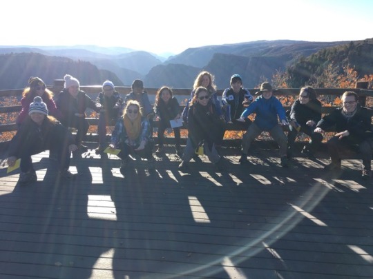
Next, we stopped at a beautiful overlook above the Little Colorado River. We spent some time observing the rocks on the overlook itself (dolostone, indicative of a shallow marine original environment… which is now several thousand feet above sea level!), as well as looking out into the canyon to compare the stratigraphy to what we had seen before and what we were expecting to see later in the day at the Grand Canyon. Just up the hill, we dropped in on some local artisans’ shops before a picnic lunch overlooking the canyon.

Artisanal craft-work

The overlook was adorned with a couple of particularly fun signs:

Control your children and pets

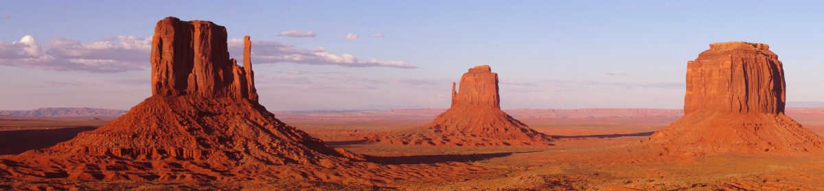
And then, on to the Grand Canyon!

Wow, that’s Grand.

On a beautiful sunny October day, we entered the most fantastic display of the erosional power of water … the Grand Canyon. The air was pleasant; soft clouds floated across the sky. Some of us closed our eyes as we approached the canyon, wanting to take in the view all at once.

Group

Stretching before us was miles and miles of rock. Big, beautiful, old rocks. For most of us, this was our first time laying eyes on a geologic mystery. How did the Grand Canyon really come to be?

GC

Many of us grew up believing that the Grand Canyon was incised by the Colorado River just about 6 million years ago, but this is still a conversation within the geological community. The Colorado River is a powerful river. It carries 500,000 TONS of sediment to the ocean every day and drops 10 feet per mile.

GSA

One hypothesis argues that the canyon was formed 70 million years ago by paleorivers and that the Colorado River did not play a major role in the formation of the canyon. Another hypothesis postulates that the the Grand Canyon was formed by linking canyons of varying ages together. Based on thermochronological data, the oldest section formed 70 million years ago, and the youngest sections were formed by the Colorado River 6 million years ago.

Present

The Grand Canyon is nothing short of incredible. All of the water in all of the world’s rivers would only fill the canyon halfway. The oldest rock formation in the canyon, the Vishnu Schist, is over 1 billion years old. Looking at the canyon is like looking back in time, because the rock walls reveal millions of years of history.

Selfie
Museo
P.S. We saw an elk!

Mesa Verde!!

Today, starting off with an early 6:30 alarm we all piled into the cars at 8 am to start our day! Our hotel in Cortez is located about 30 minutes from the field spot where we spent the whole day: Mesa Verde.

A panorama of Mancos Shale

Mesa Verde, Spanish for green table, is widely known for its Puebloan cliff dwellings and clear stratigraphy. The day started off with a couple amazing outlooks into the basin adjacent to Mesa Verde. The basin is predominantly Mancos Shale from the late Cretaceous with a thin layer of loess, extensive wind-blown sediment that in this case is highly Mg and Fe rich from ancestral volcanic activity. The loess allowed from fertile soils and was probably very enticing from the Puebloan people who were largely agricultural.

Cliff house

A few of our outlook stops allowed us to easily see various successive formations within the Mesa Verde Group, (1) the Point Lookout Sandstone, characterized by its cross bedded sandstone with a marine facies; (2) the Menefee Formation, characterized by its terrestrial deposits (like low-grade coal that we saw a lot of in the field); (3) Cliff House Sandstone, characterized by two massive sandstone beds with a thin shaley layer in between, also from a marine depositional environment. This succession allowed us to easily see the transgressive-regressive-transgressive movement of the interior seaway over the course of the Cretaceous.

After discussing more about the history of the Western Interior Basin and the stratigraphy in Mesa Verde, we stopped for a quick lunch before meeting our Park Ranger guide. With her, we scaled a 30 ft, steeply inclined ladder (which was way scarier for us than it feels to write or read) to an actual puebloan cliff dwelling, nestled in the Cliff House Sandstone, about 50 ft down from the rim of the canyon. We learned about the intricacies of their advanced technologies while peeking into their cooking spaces and bedrooms. It felt so special to see such an exclusive nook in American Indian history that has largely been erased forgotten, or excluded from textbooks. The tour ended with a couple very steep ladders and stairs carved into the near-vertical sandstone walls but with a lot of screaming and adrenaline, we made it back to the top.

Lining up for the 30ft ladder

Our last adventure for the day consisted of a 2.5 mile hike down the canyon wall into the basin, back up again and a jaunt around half of the rim back to the visitor’s center. The hike down was absolutely beautiful and the panoramic views were unparalleled to our past experiences. Some of the basin walls were covered in petroglyphs that the class had a good time trying to interpret before using our hands and knees to get back up the steep incline to the rim.

Trail view

Petroglyph in the shades

Happy Geo people!!

Open letter to the Gunnison

Gunnison River— we have to talk.
You cut through Precambrian crystalline basement? What? Who does that?

YOU!!!

I know, I know, it’s not your fault. You carved out the Black Canyon because the San Juan & West Elk mountains forced you to flow in that area, but… really?

I suppose it’s nice, then, since you expose so much cool rock? We get to see a nonconformity of Cretaceous shale on top of the Precambrian metamorphic gneiss. Gunnison, you’ve showed us what we’re missing: 370 million years! Of! History!

And the pegmatite dikes, of course. Those painted dragons squiggling across the rock face. Granitic intrusions through the gneiss? Wow, Gunnison, ok, thanks for showing us this.

dikes???

At the rim of the canyon you’ve carved still more to be seen–cordillerite, amphibolite, transpositional and isoclinal folds, and sheer cliffs with old faults and joints.

whaaat!!!
Rocks tell us stories of the climate, weathering the rocks. Twice we hiked trails near your rim, dipping just below once. We saw the canyon laid out before us, blending into the younger rocks at the end of the second trail. You help us visualize the processes behind continent building, behind the Laramide Orogeny… hey, Gunnison?

I think we… love you?

SMONCH